Geography
Local Resources
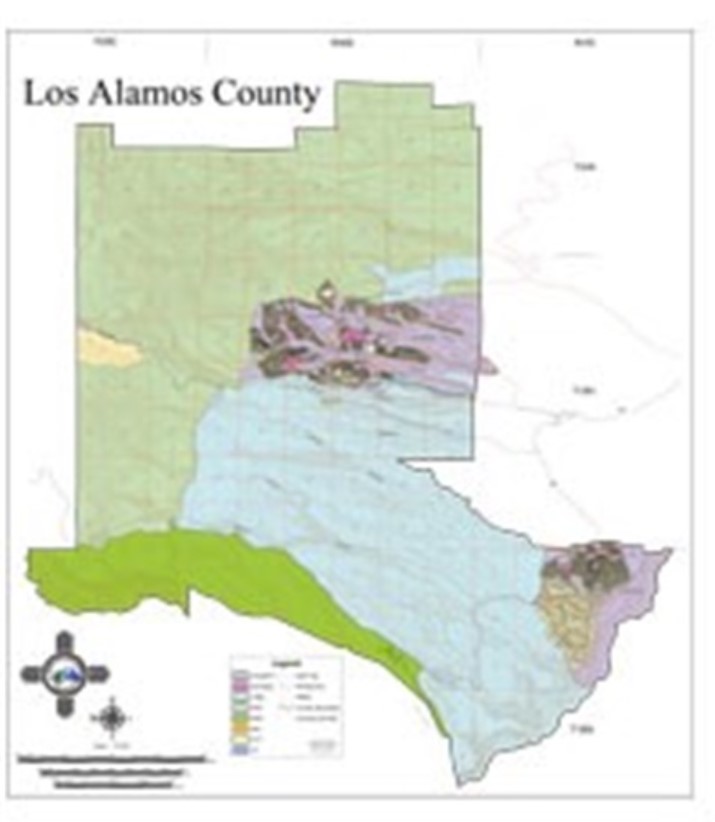 Los Alamos County Geographic Information System (GIS)
Los Alamos County Geographic Information System (GIS) Services is part of the Information Technology Division. The general mission of the GIS program is to support Los Alamos County government with geographic information technology for analysis and decision-support as it pertains to geospatial information.
 Pajarito Environmental Education Center (PEEC) Nature Guides and Los Alamos Trails App
Pajarito Environmental Education Center (PEEC) Nature Guides and Los Alamos Trails App allows you to search for a nearby trail that fits your hiking criteria. Looking to hike 2 miles with dogs? How about a snowshoe hike with your kids? This app will tell you your options and exactly where to go.
 Visit Los Alamos Brochures & Maps
Visit Los Alamos Brochures & Maps provides Los Alamos Regional Maps, Tour Maps, Trail Maps, and a variety of Brochures.
 USGS Geologic Maps
USGS Geologic Maps of the Los Alamos County New Mexico region and surrounding regions, include topographical maps.
 Layers of Santa Fe StoryMap
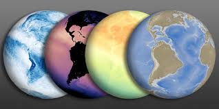
ArcGIS StoryMaps are a type of digital story-telling platform that combines images, text, and video to enhance learning and illustrate spatial relationships with a visual appeal. This StoryMap is an assembly of maps starting with the spatial geology, topography, types of vegetation, air flow, and land use of the state and region.
 Los Alamos County Quick Facts Census Information
Los Alamos County Quick Facts Census Information provides United States Census, Quickfacts Los Alamos County, New Mexico
State and Federal Resources
 Office of the State Engineer (OSE)
The Office of the State Engineer (OSE) Enterprise Geographic Information System (EGIS) are providing maps, geospatial data, and other information for public access.
 Earth Data Analysis Center (EDAC)
Earth Data Analysis Center (EDAC) at The University of New Mexico (UNM) develops, manages, and enhances the New Mexico Resource Geographic Information System (RGIS) Program and Clearinghouse. Nationally, NM RGIS is among the largest of state-based programs for digital geospatial data and information and continues to add to its data offerings, services, and technology.
 New Mexico Bureau of Geology & Mineral Resources, New Mexico Institute of Mining and Technology (NM Tech)
New Mexico Bureau of Geology & Mineral Resources, New Mexico Institute of Mining and Technology (NM Tech) provides historical and current data and information regarding New Mexico's mining, mineral, and natural resources.
 LOGIC (Land Office Geographic Information Center)
LOGIC (Land Office Geographic Information Center) Interactive Maps and GIS Data, New Mexico State Land Office provides General Land Status mapping application provides an overview of state trust lands, federal surface ownership, and the leasing activities taking place on state trust lands.
 New Mexico's Energy, Mineral and Natural Resources Department
New Mexico's Energy, Mineral and Natural Resources Department - Annual Reports
Online Databases
 New Mexico Area and Zip Codes Database
New Mexico Area and Zip Codes Database - (map)
 U.S. Board on Geographic Names (BGN)
The U.S. Board on Geographic Names (BGN), United States Geological Society comprises representatives of Federal agencies concerned with geographic information, population, ecology, and management of public lands.
 USGS Earth Explorer
The USGS Earth Explorer data portal is your one stop shop for obtaining geo-spatial datasets from our extensive collections. Users can search by exact location via the interactive map or input specific coordinates to view what data types are available.
 NASA Earth Observations
Browse and download imagery of satellite data from NASA's constellation of Earth Observing System satellites. Over 50 different global datasets are represented with daily, weekly, and monthly snapshots, and images are available in a variety of formats including JPEG, PNG, Google Earth, and GeoTIFF.
Websites
 American Association of Geographers (AAG)
The American Association of Geographers (AAG) promotes discussion among its members and with scholars in related fields, in part through the activities of its affinity groups and more than 60 specialty groups. Provides Links to Geography Associations worldwide.
 ISRIC - World Soil Information
ISRIC - World Soil Information (Soil Geographic Database) page attempts to catalogue all freely-downloaxdable primary soils information usable in a GIS either as "point" observations, polygon maps, or gridded maps ("rasters"). Many of the linked sites also have interpreted information.
 New Mexico State Library
New Mexico State Library provides links to New Mexico specific Census data, both current and historic.